QQ登录

只需一步,快速开始

最新观测显示火星存在远古河床蜿蜒1500公里最宽处7公里

[复制链接]
三叶观天 发表于 2013-1-19 23:26 | 显示全部楼层 |阅读模式 来自: 中国–广西–百色 电信

马上注册,结交更多好友,享用更多功能,让你轻松玩转社区。

您需要 登录 才可以下载或查看,没有账号?加入牧夫(请注明天文爱好者,否则无法通过审核,请勿使用gmail/outlook/aol/icloud邮箱注册)

×
本帖最后由 三叶观天 于 2013-1-21 10:05 编辑

http://tech.qq.com/a/20130119/000039.htm
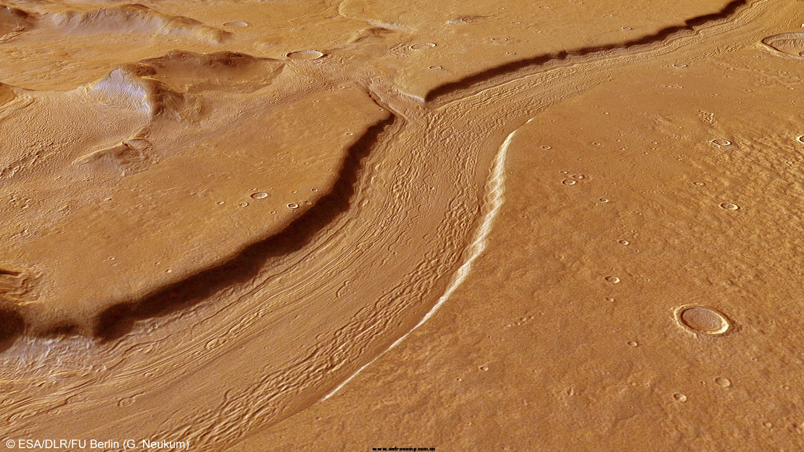
UpperReullVallis_Perspective1.jpg
到ESA找到大图100% 裁剪未2400x3600
RV2436.jpg


火星快车探测器最新观测显示,火星表面存在类似河床的地质结构,位于雷纽尔洼地

腾讯科学(悠悠/编译) 据英国每日邮报报道,目前,欧洲宇航局最新公布一系列图像,显示火星表面曾存在着一条巨大的河流,宽7公里,长1500公里,深300米。

欧洲宇航局火星快车探测器发现雷纽尔洼地具有类似河流结构,认为这里远古时期曾有水流。远古水流进入海拉斯盆地之前,在普罗梅瑟特拉高地冲刷形成陡峭的侧槽。这个令人惊异的河床结构,在火星表面蔓延1500公里,侧翼形成许多支流。


登录/注册后可看大图

火星雷纽尔洼地的图像数据

专家指出,这些图像与地球遭受冰川作用的地形十分相似。例如:我们在充满沉积物的陨坑内壁中可看到圆形结构。

行星科学家认为,这可能代表这里曾有河流或者冰川,之后冰水在不同时期升华或者蒸发。火星快车探测器最新勘测图像显示,雷纽尔洼地的河床接近7公里宽,300米深。

1600x700缩略图
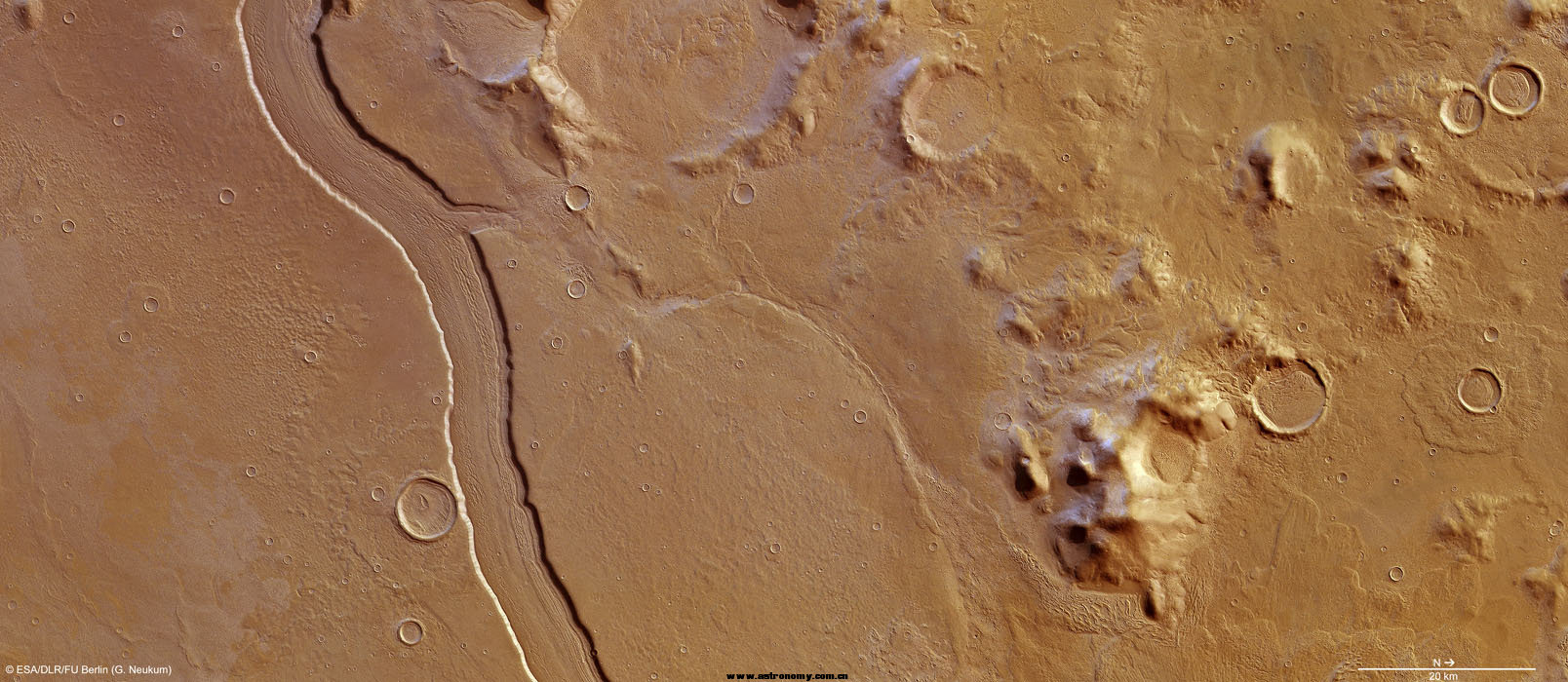
UpperReullVallis_Colour.jpg
74M原图下载地址:http://spaceinimages.esa.int/Images/2013/01/Reull_Vallis

这个类似河流的通道宽7公里,深大约300米,被认为存在流动水,能够冲刷高地形成平坦的平原


登录/注册后可看大图

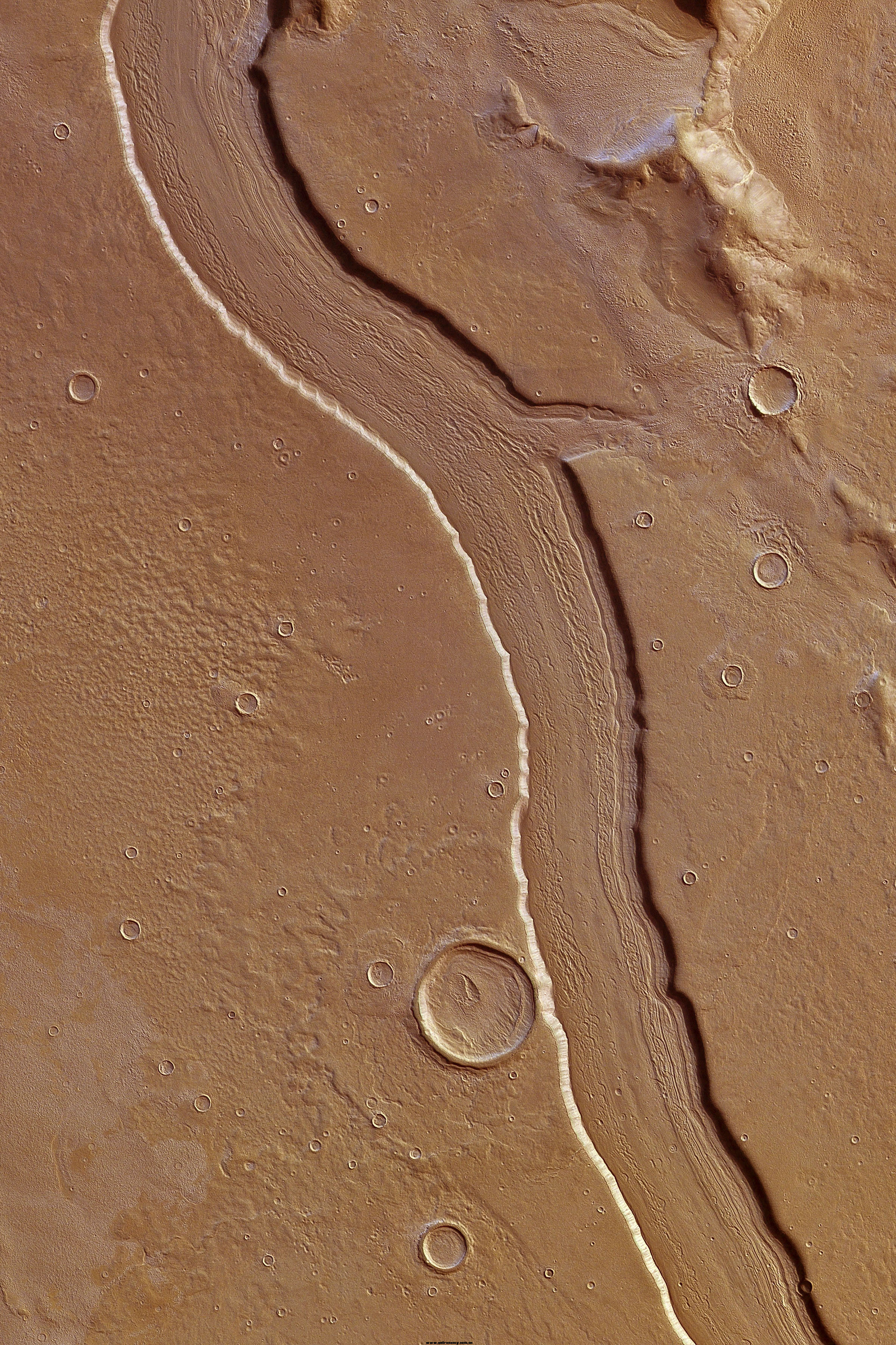
图中显示雷纽尔洼地的侧壁非常锋利和陡峭,在类似河床的通道中具有平行纵向特征。这种奇特结构被认为是亚马逊纪时期伴随着冰川流动,冰层和松散残骸物流经冲刷所致。

在35亿年前至18亿年前的赫斯伯利亚纪时期,该地区最初被液态水冲刷,最终形成这种表面结构。类似的条纹表面结构,被认为富含冰水物质,这样的情况出现在周围的陨坑之中。


登录/注册后可看大图

邻近雷纽尔洼地的普罗梅瑟特拉高地,图中前景位置是一个碰撞陨坑

图像右侧显示普罗梅瑟特拉高地的较高和松散圆形山脉,比周围平坦平原高大约2500米。雷纽尔洼地的独特结构表明,火星远古时期曾遭受复杂多样的变化,这与地球上冰川活动性具有类比性。

这种类比性可以帮助行星地质学家洞悉火星远古地质特征,这与现今地球的地质结构的历史演变存在着近似性。


milaoshu64 发表于 2013-1-20 11:00 | 显示全部楼层 来自: 中国–天津–天津 联通
人类真的很伟大!但愿有生之年能看到人类登火星成功。
回复 顶~ 砸~

使用道具 举报

索理客 发表于 2013-1-20 11:17 来自手机 | 显示全部楼层 来自: 中国–江苏–无锡 电信/IDC机房
看样子是冰川融冰冲积的峡谷河床,和地球上很多冰川冲积峡谷很像,不是河流。
回复 顶~ 砸~

使用道具 举报

 楼主| 三叶观天 发表于 2013-1-20 12:00 | 显示全部楼层 来自: 中国–广东–深圳 电信
火星重力比地球低,尺寸会比较大。
回复 顶~ 砸~

使用道具 举报

索理客 发表于 2013-1-21 09:19 | 显示全部楼层 来自: 中国–江苏–南京 电信
三叶观天 发表于 2013-1-20 12:00
火星重力比地球低,尺寸会比较大。

尺寸不会大啊,恰恰相反因为火星重力低,刻画的效果没有地球明显,
所以这个规模的冰川融冰冲击槽在地球上会更加厉害。
回复 顶~ 砸~

使用道具 举报

 楼主| 三叶观天 发表于 2013-1-21 09:45 | 显示全部楼层 来自: 中国–广西–百色 电信
sonic5188 发表于 2013-1-21 09:19
尺寸不会大啊,恰恰相反因为火星重力低,刻画的效果没有地球明显,
所以这个规模的冰川融冰冲击槽在地球 ...

重力低不会导致物质不结实吗?不过流体的动力来源也是重力,正好互相抵消了,呵呵
回复 顶~ 砸~

使用道具 举报

人与自然 发表于 2013-1-21 09:52 | 显示全部楼层 来自: 中国–广东–中山 电信
本帖最后由 人与自然 于 2013-1-21 22:19 编辑

http://www.dailymail.co.uk/sciencetech/article-2263983/Rivers-red-planet-Astonishing-new-pictures-reveal-1500km-river-ran-Mars.html
They are yet more proof of the red planet's wet past.
The European Space Agency today released an astonishing series of pictures showing the remnants of a huge river than once ran across Mars.
Taken by the ESA’s Mars Express, they show Reull Vallis, the 'river-like structure' is believed to have formed when running water flowed in the distant martian past.

                               
登录/注册后可看大图
This computer-generated image of a river-like feature in the Reull Vallis region of Mars was created using data from the Mars Express spacecraft


登录/注册后可看大图
The images were taken from data collected in the Reull Vallis region of Mars, shown here


登录/注册后可看大图
The river-like channel is 7 km wide, and a depth of around 300m. It is believed to have been formed by flowing water, which cut through highland terrain and formed smooth plains.


登录/注册后可看大图
This colour-coded overhead view reveals the depth of the craters and river beds

These structures are believed to be caused by the passage of loose debris and ice during the ‘Amazonian’ period (which continues to this day) due to glacial flow along the channel.
The structures were formed long after it was originally carved by liquid water during the Hesperian period, which is believed to have ended between 3.5 billion and 1.8 billion years ago.
Similar lineated structures, believed to be rich in ice, can also be found in many of the surrounding craters.


登录/注册后可看大图
The Mars Express craft was also able to produce this 3D image of the area thanks to its twin cameras

The right (northern) part of the main image is dominated by the Promethei Terra Highlands with their high and soft-rounded mountains shown in these images, rising around 2500 m above the surrounding flat plains.
'The morphology of Reull Vallis suggests it has experienced a diverse and complex history, with analogies seen in glacial activity on Earth.
'These analogies are giving planetary geologists tantalising glimpses of a past on the Red Planet not too dissimilar to events on our own world today.'


登录/注册后可看大图
回复 顶~ 砸~

使用道具 举报

索理客 发表于 2013-1-21 11:59 | 显示全部楼层 来自: 中国–江苏–南京 电信
三叶观天 发表于 2013-1-21 09:45
重力低不会导致物质不结实吗?不过流体的动力来源也是重力,正好互相抵消了,呵呵
...

一般的重力对固体密度影响很小的
回复 顶~ 砸~

使用道具 举报

gohomeman1 发表于 2013-1-21 17:35 | 显示全部楼层 来自: 中国–浙江–宁波 电信
竟然不是著名的水手峡谷?
回复 顶~ 砸~

使用道具 举报

 楼主| 三叶观天 发表于 2013-1-24 10:03 | 显示全部楼层 来自: 中国–广西–百色 电信
gohomeman1 发表于 2013-1-21 17:35
竟然不是著名的水手峡谷?

这个估计只相当于水手峡谷里的一条支流吧
回复 顶~ 砸~

使用道具 举报

天文爱好者3号 发表于 2013-1-24 16:54 | 显示全部楼层 来自: 中国–北京–北京 联通
有点像一个泥潭表面有条虫子爬过的痕迹!
回复 顶~ 砸~

使用道具 举报

本版积分规则

APP下載|手机版|爱牧夫天文淘宝店|牧夫天文网 ( 公安备案号21021102000967 )|网站地图|辽ICP备19018387号

GMT+8, 2024-11-30 19:01 , Processed in 0.091626 second(s), 8 queries , Gzip On, Redis On.

Powered by Discuz! X3.5 Licensed

Copyright © 2001-2020, Tencent Cloud.

快速回复 返回顶部 返回列表